Overview
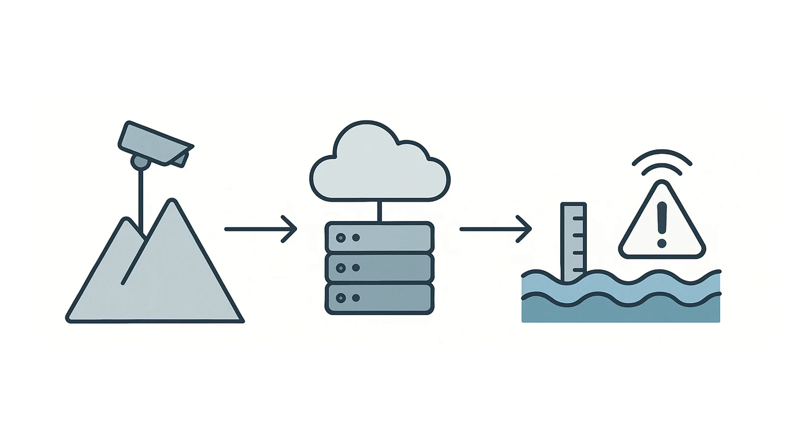
This project developed a cloud-enabled water level monitoring and early-warning system designed to improve flood prediction and environmental safety. By using high-resolution cameras installed at elevated points, including mountain regions and riverbanks, the system performs long-term visual surveillance of river water levels. Data is continuously processed and stored on cloud servers, enabling real-time monitoring and historical analysis to support proactive flood prevention and infrastructure resilience.
Technical Approach
- Edge Video Capture — solar-powered cameras for 24/7 operation in remote areas.
- Cloud Processing — data transmitted via secure IoT channels for automated analysis.
- AI-Based Water Level Estimation — algorithms detect river boundaries and estimate level variations through time-series visual analytics.
- Alert Mechanism — automated notifications triggered when significant deviations or flood risks are detected.
Expected Outcomes
- Improved early flood detection through continuous river monitoring.
- Cloud-based data architecture enabling real-time access and predictive insights.
- Reduced environmental risk and better protection of downstream communities.
- Open framework adaptable to other geographic regions and environmental monitoring projects.